
Ever thought a local Vancouver hike might change the way you see nature? This guide offers a little something for everyone. You'll find easy strolls as well as a brisk 10 km trek that leaves you grinning.
We share key details like how far you'll go and the climb (that means the total rise in elevation) so you can choose a route that fits your vibe. Imagine stepping onto a trail where the cool, crisp air and amazing views greet you with every step.
Ready to lace up your boots and see nature from a whole new angle?
Vancouver Hikes Overview: Key Trail Metrics
If you’re itching to hit the trails around Vancouver, this guide is your go-to. It lays out each hike’s distance, climb (elevation gain), difficulty, and the best spots for stunning views. Think of it as your quick trail map when planning a day out, whether you’re gearing up for a long trek or just a chill stroll in nature.
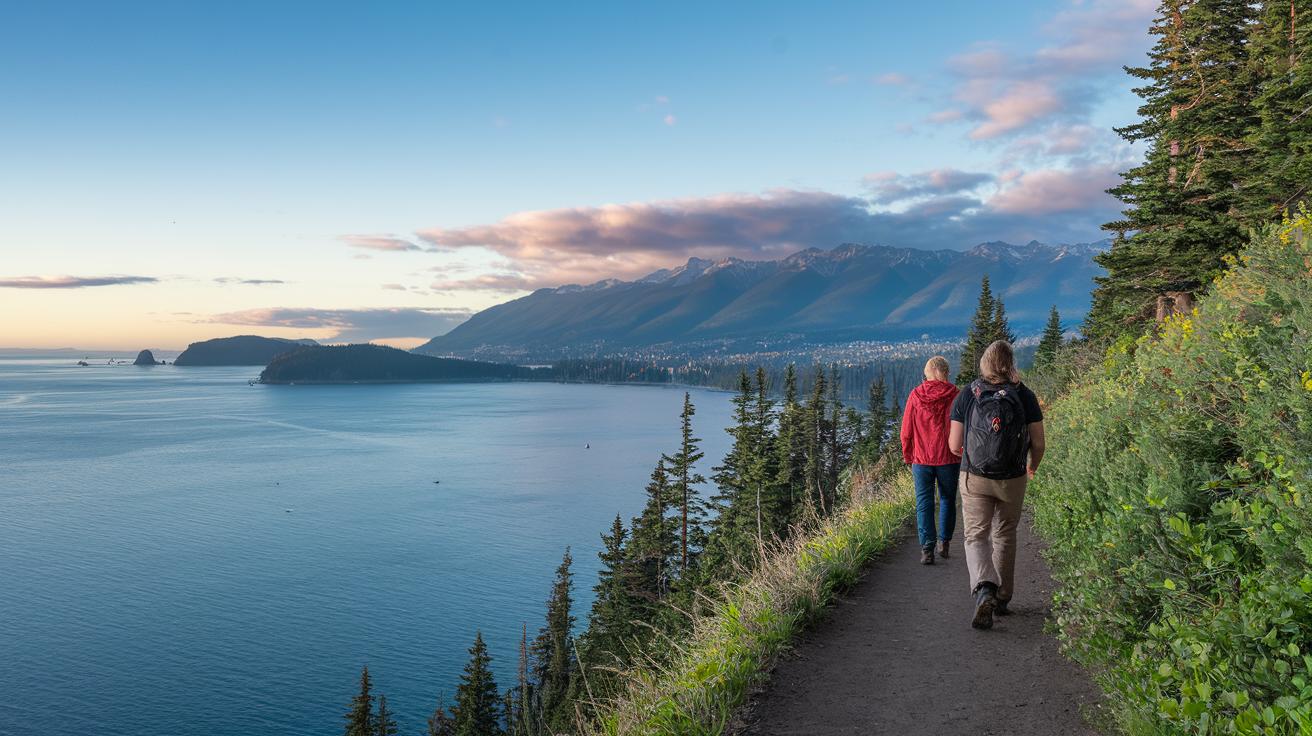
Imagine stepping out into the crisp air on a 10 km round hike with vast, open views that take your breath away. Or maybe you’d prefer an easier, shorter walk that gifts you charming city and inlet panoramas. For instance, if Howe Sound’s beauty mixed with a moderate climb sounds appealing, try Saint Marks Summit. Picture wrapping up a 10 km round hike and catching a sunset that lights up the water in a magical way.
Not ready for a big challenge? Dog Mountain offers a friendly 4.8 km round trip that’s perfect for beginners. And if you’re craving a serious workout, the Grouse Grind tests your endurance with a steep, fitness-focused ascent over a short distance.
Take a look at the details below to compare the trails and find the one that matches your pace and sense of adventure.
| Trail Name | Distance | Elevation Gain | Difficulty | Highlight |
|---|---|---|---|---|
| Saint Marks Summit | 10 km round trip | 570 m | Moderate | Views of Howe Sound |
| Mount Strachan | 7.2 km round trip | 590 m | Moderate | Forested ridge |
| Tunnel Bluffs | 7.4 km round trip | 689 m | Moderate | Panoramic bluff overlooks |
| Dog Mountain | 4.8 km round trip | 162 m | Easy | City and inlet vistas |
| Grouse Grind | 1.9 km one-way | 780 m | Hard | Fitness-focused trail |
Vancouver Hikes for Families: Beginner and Family-Friendly Trails
Dog Mountain is a great choice for families and anyone just starting out on the hiking trail. This hike is a friendly 4.8 km round trip with only a 162 m climb. The path has wide, gentle turns and clear signs that make it easy to follow, imagine a well-worn trail that feels as welcoming as a friendly neighborhood road.
Over on Seymour and Cypress, you'll find similar beginner trails. These routes are less than 5 km long with climbs under 200 m. They have clearly marked paths so that kids and first-timers can hike with confidence. It’s like having a clear map that guides you step by step through nature’s playground.
If you’re looking for trails that are easy to get to by bus, these routes are perfect. The trailheads are right near local bus stops, which means more time enjoying the fresh air and less time worrying about parking.
- Family friendly trekking
- Beginner circuit guides
- Easy mountain ascents
Try these trails for a laid-back day outdoors, where a slow pace and clear direction let you take in the crisp mountain air and stunning views without any stress.
Vancouver Hikes in the North Shore Mountains
Cypress Mountain Hikes
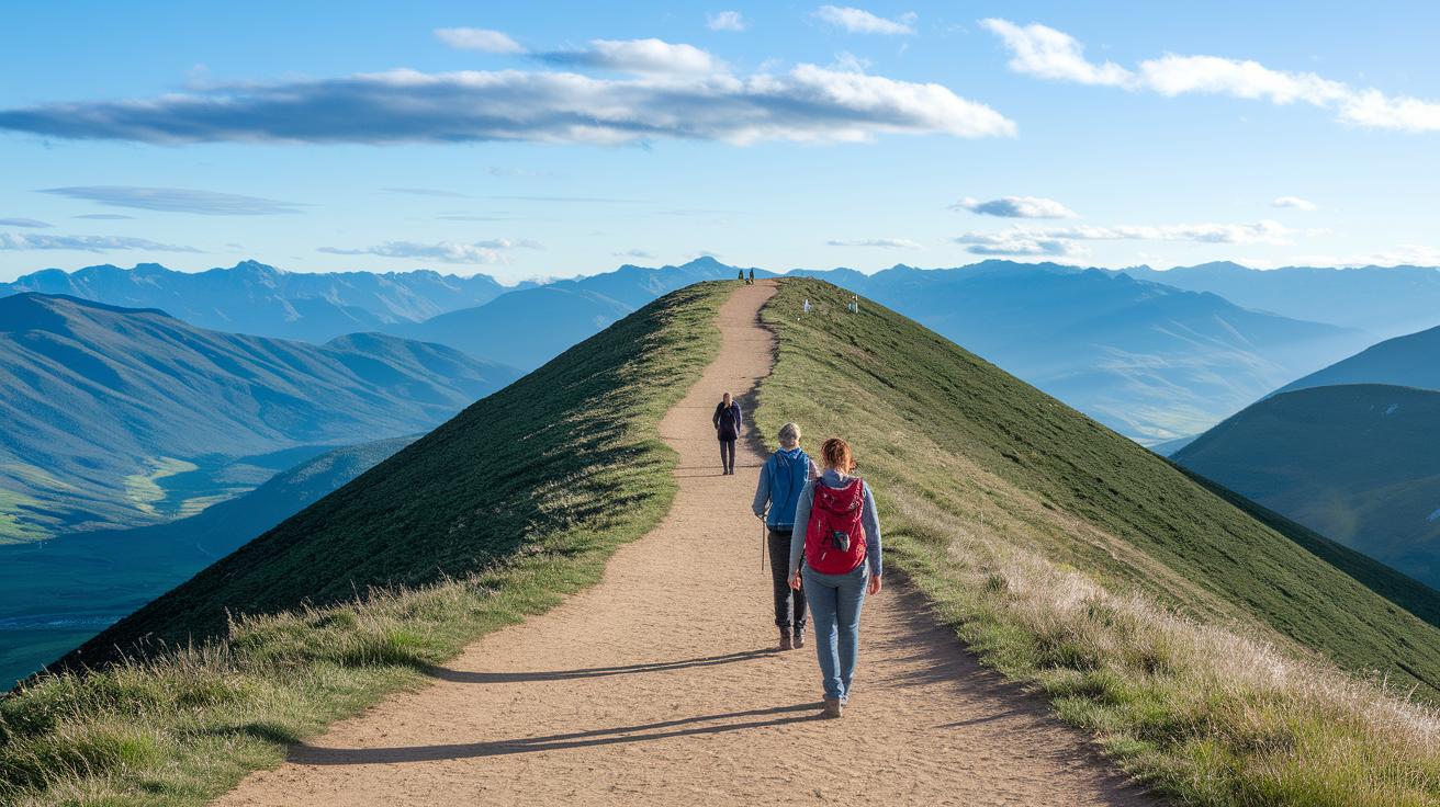
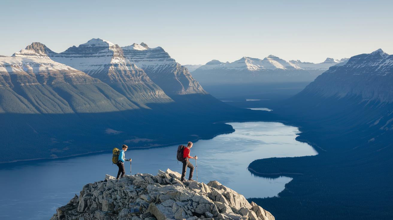
Imagine stepping into the fresh, crisp mountain air at Cypress Mountain. One trail, Saint Marks Summit, is a friendly 10 km round trip with a 570 m climb that treats you to wide, open views of Howe Sound. It’s a moderate hike that makes every step worth it. Then there's Mount Strachan, a 7.2 km round trip that climbs 590 m, meandering along a shady, forested ridge where you can really relax and soak in nature’s calm. Up next is Tunnel Bluffs, a 7.4 km trek with a 689 m climb, that leads you to dramatic bluff overlooks where coastal beauty unfolds before your eyes. For a gentler wander, try Hollyburn Peak. At 7.9 km with a 432 m climb, it takes you through a peaceful forest with a softer challenge. And if you’re up for a real test, Unnecessary Mountain awaits. This 15 km round trip with a 1,122 m gain rewards you with rugged wilderness and breathtaking vistas. Ever finished a long hike and felt on top of the world? That’s the magic waiting for you there.
Mount Seymour Hikes
Mount Seymour caters to everyone, from easy-going explorers to those looking for a tougher adventure. The main trail is an 8.2 km journey with a 564 m climb that weaves through colorful woodlands and varied terrain. It feels like strolling amidst nature’s art. For the full-day adventurers, Elsay Lake is calling with its 17.5 km route and 1,116 m climb. Every twist reveals secret spots of calm beauty, making it a perfect day-long escape.
Grouse Mountain Hikes
Grouse Mountain offers a mix of lively challenges and stunning scenery. The BCMC Trail is a 2.4 km one-way path with a 791 m climb that tests your stamina on steep ground. Then there’s the Flint & Feather Trail, a 3.4 km round trip with a 770 m climb. It’s a steep, energetic route where you feel the raw power of nature with every step. Crown Mountain wraps things up with a longer 9.2 km round trip and an 866 m climb that delivers grand, sweeping views at the summit. Each trail on Grouse Mountain invites you to push your limits while enjoying the spirit of British Columbia’s wild outdoors.
Vancouver Hikes Planning Essentials: Gear, Permits, and Safety

Before you hit the trail, get your gear in order and calm your mind with these easy tips:
-
Check trail conditions on sites like VancouverTrails.com or AllTrails.com. It’s like looking at a map before a big adventure. Make sure you know the weather and any surprises along the way.
-
Dress in layers with waterproof stuff. This way, you can add or remove a layer as the weather changes, just like staying cozy when a light drizzle turns into a downpour.
-
Pack your essentials. Bring water, high-energy snacks, a map or an offline GPS app, sunblock, and a basic first-aid kit. Think of it as filling your backpack with all you need to enjoy the hike without worry.
-
Always have a fully charged phone and a power bank. Imagine being deep in the forest and that extra bit of battery life coming in handy, it really can be a lifesaver.
-
Be bear-aware by hiking in a group, keeping some noise, and carrying bear spray if you’re headed into areas where critters might roam. It adds that extra bit of caution with every step you take.
-
Tell a trusted friend or family member your route and when you’ll be back. A quick message can make all the difference if something unexpected happens.
-
Follow parking rules at trailheads and stick to Leave No Trace principles. This helps keep the outdoors as beautiful and clean as your favorite camp spot.
-
Always check the latest weather before you leave. If the forecast looks iffy, it might be best to postpone your hike. After all, being safe is the best way to enjoy nature.
Vancouver Hikes Navigation: Map Tools and Transit Access

When you're gearing up for a hike, it all starts with finding your way. Try using sites like VancouverTrails.com and AllTrails.com, they offer downloadable GPS maps and real-time trail updates, kind of like having a trusty guide right in your pocket. These tools lay out detailed routes so if the trail gets tricky, you always have a backup plan. And if you’re worried about losing signal, you can download offline sections on your phone.
Popular spots like Cypress and Seymour are a breeze to reach by bus, so check local transit times and make your trip smoother. If you’re driving, it’s wise to verify parking availability on the park’s website before you head out. That way, you avoid any last-minute surprises when you get to the trailhead.
- Use digital tools for clear map directions and live trail reports.
- Download offline maps on your smartphone to steer clear of dead zones.
- Check bus schedules to reach popular trailheads hassle-free.
- Confirm parking status online before you start your journey.
Final Words
In the action, this guide laid out key trail stats, from moderate ascents to family-friendly circuits, offering clear tips for gear, maps, and safety. It gave a quick look at top routes, handy for planning a day under the sky. Vancouver hikes come alive with scenic overviews and practical advice that makes every step a little easier. Enjoy the crisp air, follow the trail markers, and have fun exploring these beautiful paths. Embrace every moment out on those Vancouver hikes, and happy trails!
FAQ
What Vancouver hikes provide a stunning view?
The Vancouver hikes with a view offer clear, striking scenes from high summits like Tunnel Bluffs and expansive vistas in Stanley Park, giving you a real treat for the eyes.
What are some of the best Vancouver hikes?
The best Vancouver hikes include routes such as Saint Marks Summit, Dog Mountain, and Tunnel Bluffs, each showcasing unique terrains and offering refreshing outdoor experiences.
How can Vancouver hikes be enjoyed during February?
Vancouver hikes in February feature crisp air and quiet trails, making them a cool spot to enjoy nature. Just dress in layers and check current trail conditions before you head out.
Are there Vancouver hikes accessible by transit?
Yes, certain Vancouver hikes have trailheads easily reached by local bus routes, which lets you explore the outdoors without needing a car.
What are some easy hikes available in Vancouver?
Easy hikes like Dog Mountain provide clear, marked paths and gentle slopes, making them perfect for families and first-timers looking to soak in nature’s charm.
Is there a Vancouver hikes map available for planning?
Vancouver hikes maps, found on sites like VancouverTrails.com and AllTrails.com, offer interactive and downloadable routes along with up-to-date trail details for handy planning.
What does the Quarry Rock hike offer and what is AllTrails Vancouver?
The Quarry Rock hike offers a short, scenic route with great panoramic views, while AllTrails Vancouver is a useful resource for real-time reviews, maps, and route details to help you plan your next outdoor outing.
| Trail Name | Distance | Elevation Gain | Difficulty | Highlight |
|---|---|---|---|---|
| Saint Marks Summit | 10 km round trip | 570 m | Moderate | Views of Howe Sound |
| Mount Strachan | 7.2 km round trip | 590 m | Moderate | Forested ridge |
| Tunnel Bluffs | 7.4 km round trip | 689 m | Moderate | Panoramic bluff overlooks |
| Dog Mountain | 4.8 km round trip | 162 m | Easy | City and inlet vistas |
| Grouse Grind | 1.9 km one-way | 780 m | Hard | Fitness-focused climb |