
Ever wonder if a perfect sunny walk is just around the corner? With a free mapping app, you can find local trails in a few simple clicks. This guide helps you choose the perfect path for your mood, whether it’s a relaxed stroll or a brisk hike where you can really take in the cool, quiet nature. So if you're ready for some fun, sun-filled adventure nearby, keep reading to discover a trail that feels just right for you.
Find Nearby Hiking Trails with Mapping Tools

Ever thought about finding your next trail adventure with just a few clicks? Simply type in your ZIP code or address into a free mapping app, and in seconds, you'll see a bunch of nearby paths waiting for you. Imagine entering your address and instantly getting options from calm park strolls to more challenging climbs along wooded trails. It’s as simple and satisfying as checking the weather before a day out.
Next, play around with the filters to match your mood and energy. Many of these tools let you sort trails by distance, how steep the climb (elevation gain), and even what facilities are nearby. So whether you’re in the mood for a relaxed walk or craving a bit more of a challenge, you can easily pick the right one.
Finally, take a moment to skim through trail ratings and reviews from other hikers. Look for key details like the distance, how long it usually takes, and what kind of terrain you’ll encounter. You might read a review saying, "Perfect for a quick, scenic walk with a few gentle uphill stretches." These little tips can help you choose a trail that fits your day perfectly.
Top Nearby Hiking Trails in the City

Ever feel like swapping the hustle and bustle for a quiet moment in nature? Urban trails let you step away from honking horns and busy streets to enjoy the gentle rustle of leaves and a warm, peaceful walk. These trails are like little pockets of wild right in the town, perfect for a sunny stroll or even a little more spirited adventure if you’re in the mood. They’re a great way to recharge your batteries, enjoy a fresh burst of outdoor air, and sneak in some exercise without leaving the city.
| Trail Name | Description |
|---|---|
| Frick Park | Diverse loops in 600 acres with forests, meadows, and streams, great for all hikers. |
| Schenley Park | Lakeside paths with short loops that offer lovely views of the skyline. |
| Riverview Park | Wooded trails that lead to Observatory Hill and the historic Allegheny Observatory, touching on local heritage. |
| Beechview-Seldom Seen Greenway | A calm, hidden forest path perfect for a quiet, undisturbed walk. |
| Mount Washington Trails | Routes with steep climbs and rewarding views that span the entire city. |
| Toms Run Nature Reserve | A clear 3-mile loop that works great for a brisk morning or a relaxed afternoon walk. |
| North Park | Multiple trails along with chances for canoeing, kayaking, or a quick pickleball game. |
| Fall Run Park Trail | A 1.4-mile path that ends at a charming waterfall, perfect for family outings. |
Pick a trail that fits your time and mood, and enjoy a sunny escape right in the heart of the city.
Scenic Nearby Hiking Trails Beyond Urban Limits

McConnells Mill State Park gives you a chance to leave the city's buzz behind. Its Slippery Rock Gorge Trail winds through a deep, rugged gorge near an old mill. The 3-mile loop is just a 20-minute drive away. You can enjoy rocky paths, lush greenery, and the soothing sounds of cascading water, a perfect escape for nature lovers.
Ohiopyle State Park is another great spot if you're looking for a nature fix. Just a 40-minute drive brings you to trails along the lively Youghiogheny River. Trails like Ferncliff Peninsula and Cucumber Falls offer everything from gentle streams to steeper climbs. And on the Laurel Highlands Trail, you can marvel at natural water pathways and green surroundings that refresh your spirit.
Moraine State Park is all about peaceful beauty. The Glacier Ridge Trail meanders through thick forests and by calm lakes. Located about an hour north of the city, it offers a quiet walk where shaded woodlands meet sparkling water, a hug from nature that soothes the soul.
Raccoon Creek State Park is perfect if you’re in the mood for a little adventure and discovery. About 30 minutes from downtown, its well-marked trails lead you past mineral springs and seasonal waterfalls hidden among wooded areas. It’s a place where every turn brings a new, memorable view of nature’s hidden treasures.
Each park has its own unique charm. Some trails challenge your stamina with rugged climbs, while others provide a smooth and scenic stroll where you can really soak in the beauty around you. Which path will you choose next?
Nearby Hiking Trails with Stunning Waterfalls
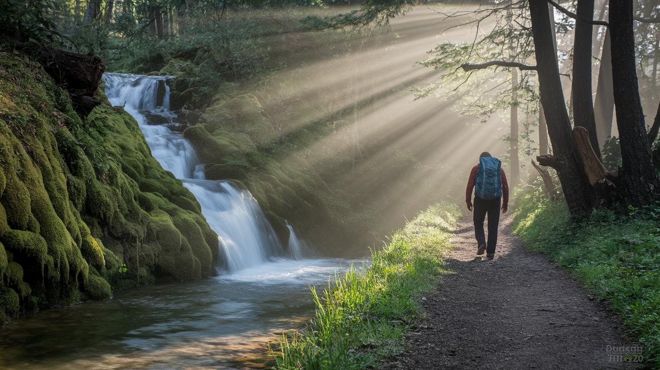
There's something magical about hearing water tumble over rocks as you hike. It turns an ordinary walk into a mini adventure filled with the sound of nature. Check out our list of waterfall trails for a fresh look at paths that bring water to life (https://blackandburlap.com?p=179).
- Fall Run Park Trail is just a 20-minute drive away, with a 1.4-mile loop that reveals a lively waterfall. Picture moss-covered rocks perfect for capturing a rustic shot.
- Over at Ohiopyle, Cucumber Falls offers a quick 0.8-mile round-trip walk that leads you to a charming cascade, where a light mist cools you off on a sunny day.
- On McConnells Mill’s Gorge Trail, a series of smaller cascades along rugged cliffs creates a natural beat as water flows over stones.
- Raccoon Creek hides a seasonal waterfall that changes with the season, offering a quiet and surprising spot for anyone who loves the soothing sound of water.
Accessible Nearby Hiking Trails for Beginners
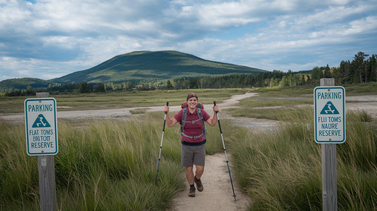
At Toms Run Nature Reserve, you'll discover a 3-mile loop on a flat, even trail that's perfect for your first outing. The gentle slope makes it easier to balance, and they've updated the parking and restrooms for better accessibility. It’s like walking on a trail that's as smooth as a freshly paved road, inviting everyone to step up and explore.
Frick Park offers peaceful routes through meadows and along streams on wide and even paths. Upgraded benches and clearly marked signs mean you can always find a spot to catch your breath and adjust your pace. Imagine strolling on a path that feels just like a well-paved sidewalk blending into nature.
At Fall Run Park, you'll enjoy paved sections near a lovely waterfall that create a safe trail for beginners. The design is thoughtful, with handrails on some spots and easy-to-find parking and restrooms. The path here is as level as a boardwalk, making every step feel secure and confident.
Moraine State Park treats you to a short walk along the lakeshore on smooth ground. With an even trail and accessible rest stops, it’s a top pick for anyone new to hiking. Picture a flat, clear path that feels like a calm promenade by the water, a soothing experience during your adventure.
Raccoon Creek is designed with safety in mind, featuring well-marked loops over flat terrain. With helpful touches like audible signs (which announce important spots) and ramped entries to facilities, you can feel confident exploring. Every twist in the path is carefully defined, ensuring a secure journey for first-time adventurers.
Before you head out, remember to check seasonal trail access since conditions and facility availability might change.
Plan Your Nearby Hiking Trails: Local Resources and Tips
Before you head out for a fun day in nature, take a few minutes to look up your local parks department website. It’s a good idea to check if any trails are closed or if there are any tricky spots on your path. Have you ever been caught off guard by a sudden storm? A quick peek at the weather can help you stay safe and get the most out of your adventure.
Then, look into what the trail has to offer. Find out about parking fees, restrooms, and water refill stations along the way. Many parks keep these details up-to-date so you can plan your breaks, just like finding a comfy spot by a campfire. Even well-marked signs and spaced-out benches can give you a little boost on a long journey.
Finally, tap into the wisdom of other hikers. Community reviews can be real lifesavers, offering the inside scoop on what to expect. Ever chatted with someone who just finished the same trail? Their tips can help you steer clear of any surprises. And if you’re still wondering, a quick call to your local parks office can give you the real-time updates you need to have a smooth, sunny day out.
Final Words
In the action, we covered how mapping tools can reveal awesome outdoor spots, from colorful city escapes to scenic paths outside town. We shared simple steps for entering your location, filtering by distance and difficulty, and checking trail ratings and reviews. Quick tips for beginners and seasoned explorers were woven in to help you plan safe outings. Use these insights to feel confident and ready when you explore those nearby hiking trails, and let every step bring a fresh smile to your day.
FAQ
What hiking trails are available near California and Texas?
The hiking trails near California and Texas offer varied terrain, from gentle coastal paths to steeper route sections, letting you choose an outing that suits your skill level and scenic preferences.
How can I find hiking trails near my location within a specific distance?
The search option using a ZIP-code or address in mapping apps helps you locate nearby trails. This tool filters by distance—like 5 or 20 miles—so you plan an outing that fits your time.
How do nearby hiking trails for beginners cater to first-timers?
These beginner trails feature flat, well-marked paths that boost confidence. They usually provide gentle, shorter routes with clear directions, making them perfect for a relaxed outdoor start.
Which nearby hiking trails are considered the best?
The best nearby hiking trails combine scenic views, safe paths, and positive user reviews. Look for ratings and simple maps that help you pick a trail that matches your available time and interests.
How can I use a hiking trail map for planning my outdoor outing?
A hiking trail map displays path details like distance, difficulty, and available amenities. Use it to quickly assess your options and plan a comfortable, safe route before you head outdoors.