
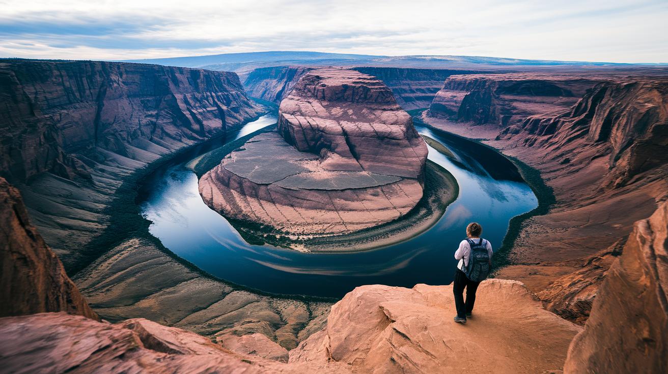
Ever wondered if a short hike could spark your spirit? Out in the Columbia Gorge, you can wander on trails that mix thrilling views with relaxed paths. Imagine strolling along a trail that leads to a stunning waterfall or taking a quiet walk beside a bubbling stream. Each step lets you leave routine behind and soak up nature's refreshing charm.
Whether you're in the mood for a quick jaunt or a full-day trek, every moment on these trails brings a new slice of outdoor fun. Picture the crisp mountain air filling your lungs and the magic of unforgettable views at every turn. So, grab your boots and head out, nature is calling, and it’s ready to recharge your soul.
Top Columbia Gorge Hikes: Detailed Day Trek Overview
Columbia Gorge is a beautiful mix of easy strolls and moderate adventures. There’s something for everyone, whether you’re up for a quick 0.4-mile walk or a longer trek over 4 miles. It’s like choosing the perfect trail based on your energy and mood for the day.
- Angel’s Rest – 4.8 mi out & back, moderate – Enjoy sweeping views that stretch across the river canyon.
- Multnomah Falls – 2.0 mi out & back, easy – Take in the famous two-tier waterfall along paths that bubble with natural beauty.
- Wahkeena Falls – 0.4 mi round trip, easy – A brisk walk lets you experience a beautiful close-up view of the falls.
- Bridal Veil Falls – 0.5–1.0 mi variations, easy – A short trail that finishes with a stunning waterfall display.
- Triple Falls via Oneonta Gorge – 3.6 mi, moderate – Wander through lush scenery that leads you to a series of sparkling cascades.
- Elowah & Upper McCord Creek Falls – 3.0 mi out & back, moderate – Discover not one but two lovely waterfalls, almost like unearthing a hidden gem.
- Ponytail Falls – 0.8 mi out & back, easy – Enjoy a quick, scenic route that’s perfect for a little nature break.
- Wahclella Falls Loop – 2.0 mi loop, easy – A gentle loop that fills your ears with the soothing sound of water.
- Punchbowl Falls – 4.5 mi out & back, moderate – A bit more of a challenge that rewards you with a peaceful waterfall experience.
- Dry Creek Falls – 4.4 mi out & back, moderate – A blend of trail adventure and captivating waterfall views to keep you inspired.
Plan ahead like you’d prep for a campfire chat, check daylight hours and get there early to snag a good parking spot. Don’t forget to pack sturdy footwear, layered clothes, and a trusty map or GPS app to guide you on your adventure.
Planning Essentials for Columbia Gorge Hikes: Permits, Parking and Tolls

If you're setting off on a hike here, know that rules differ by state. In Washington, you need your Discover Pass tucked away in your backpack along with your map. Over in Oregon, there's no permit hassle, you can just show up. Still, it's smart to check the local park details before you hit the trail.
Parking can be a bit of a wild ride at famous spots like Multnomah Falls. With only about 10 to 15 parking spaces available at popular trailheads, those spots fill up fast. I’d suggest arriving before 9 am. Not only will you snag a spot, but you’ll also enjoy the quiet of the early morning, the crisp calm before the rush.
Another tip: if your journey takes you across the Historic Columbia River Highway toll bridges, be ready for a small fee. Expect to pay roughly $2 each way. And if you’re planning a day hike during peak times, think about hopping on the seasonal Gorge Express shuttle. It runs hourly from March through October, getting you to major trailheads quickly and skipping the parking scramble.
Seasonal Strategies & Safety on Columbia Gorge Hikes

Spring and Winter Conditions
During winter and spring, you'll witness bold, roaring waterfalls paired with quieter trails. You might even catch higher water flows creating brilliant displays with fewer people around. But watch out, trails above 1,000 ft can turn icy, so tread carefully on the chilly, uneven ground. Picture a frozen creek crossing where you need to step slowly, almost like tiptoeing on a slick rock on a crisp morning.
Summer Challenges
Summer paints the landscape in bright, lush colors, though nature might reclaim parts of the trail with overgrown vegetation. With the heat on your side, be sure to carry at least 2 liters of water per person and don your sunscreen. Those wild paths can hide uneven footing, so keep your eyes on the ground and take breaks often. Imagine a sunlit trail tempting you to speed up, pausing to hydrate helps keep you safe and steady.
Fall Recommendations
Fall often brings a mix of cool, wet weather where trails near creek crossings and leaf-carpeted paths become slippery. A good pair of shoes with solid grip is your best friend here, much like having the perfect boots for a muddy patch. Before you set off, check the local NOAA Gorge-zone forecasts for any wind or weather alerts and pack a basic first-aid kit for any unexpected scrapes or sudden trail changes.
Navigation & Mapping Guide for Columbia Gorge Hikes
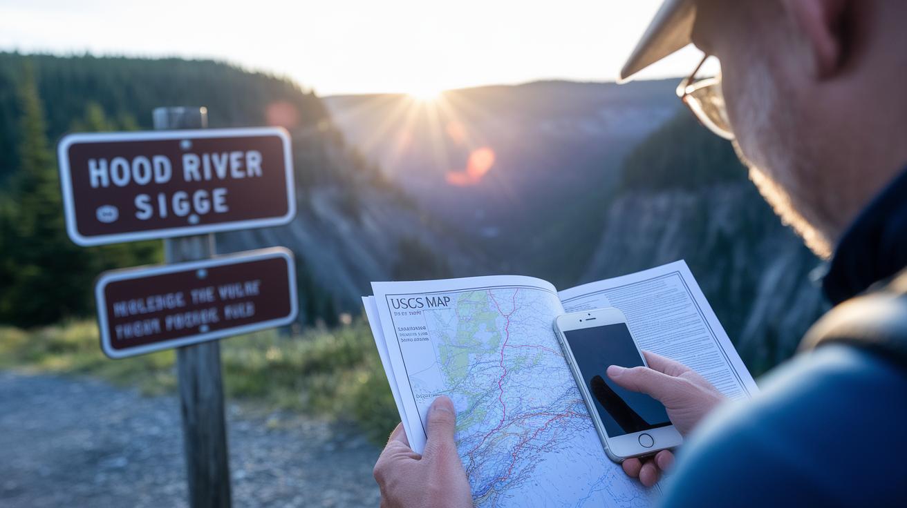
Using a trusty paper USGS map along with your smartphone’s GPS app makes planning a day on the trails feel as simple as a gentle walk in the woods. When you take a USGS topo quadrant in areas like Hood River and Multnomah Falls, you get clear details of the land with every slope and rise, even showing gains of up to 1,440 feet on a trail like the Larch Mountain Rim Loop. And tools like AllTrails and Gaia GPS help you keep track of your path even if you go offline. Plus, most trails in the Gorge have numbered signposts every half mile, so you always have a sense of where you stand.
| Map Resource | Format | Coverage |
|---|---|---|
| USGS Topo Quadrant | Paper | Hood River & Multnomah Falls |
| AllTrails App | Digital | Offline Gorge Trails |
| Gaia GPS App | Digital | Full OR–WA Gorge |
Always keep an eye on those contour lines and follow the footpath markers to stay on track. Each step of your hike becomes more secure when you know exactly where you are, like having a dependable buddy on the trail with you.
Flora, Fauna & Photography Highlights on Columbia Gorge Hikes
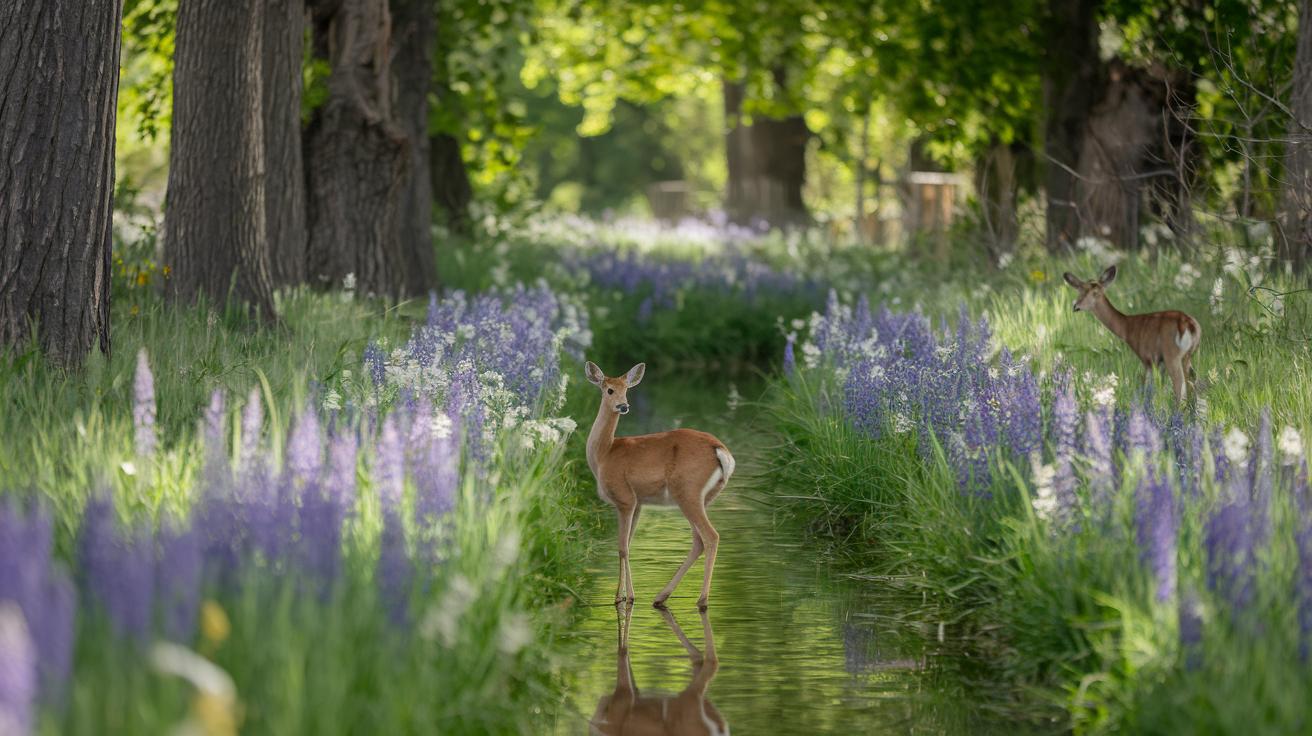
Imagine stepping into Columbia Gorge when wildflowers burst into life along the Catherine Creek loops, especially in May and June. Every footstep leads you through a natural art show where every bloom feels like a splash of color on a painter’s palette. The air is crisp, and gentle breezes rustle through the trees, inviting you to stop, breathe, and really feel nature.
As you wander this trail, keep an eye out for local wildlife. Deer meander quietly in the shade, and black-tailed jackrabbits make quick dashes across sunny spots near Dry Creek Falls. It’s like catching a secret glimpse of nature’s residents, they remind us that even in the wild, life is always near.
If you love photography, you’re in for a treat. Look for cascades where water drops turn into soft rainbows, or head to Tom McCall Point at sunrise for stunning ridgeline views. And don't miss the bold basalt rock formations along the Labyrinth Trail, they offer moments perfect for capturing the raw magic of Columbia Gorge.
Amenities & Accommodations Near Columbia Gorge Hikes

State park campgrounds are perfect for setting up your base camp before exploring the Gorge. Ainsworth State Park offers 50 spots just a mile from the stunning Multnomah Falls, while Viento State Park has 100 spots along the bright Columbia River near Horsetail Falls. These sites are neat and surrounded by natural beauty, a great place to unwind after a long day on the trails.
Picnic areas add an extra touch to your outdoor day. At the Wahkeena Falls trailhead, you'll find picnic spots perfect for a quick meal out in nature. It’s a friendly break for families and groups who might not be planning to stay overnight.
Nearby towns like Hood River have cozy bed and breakfasts, local breweries, and farm-to-table restaurants serving fresh, local flavors. These stops offer a warm retreat where you can recharge after a busy day exploring the outdoors.
Before heading out, double-check your gear list and pack light to make camping a breeze. And if you need a hand with overnight plans, check out this helpful guide with a camping essentials checklist for all your gear tips.
Final Words
In the action, we explored a variety of routes ranging from short waterfall treks to longer routes with stunning views. We reviewed permits, parking tips, and seasonal safety hints. We also shared smartphone and paper map tips and even highlighted top spots for nature photography and nearby accommodations.
Each section offers useful pointers to help you plan safe, memorable columbia gorge hikes. Enjoy your time outdoors and make every step count!
FAQ
What are some popular Columbia Gorge hikes with waterfalls?
The Columbia Gorge hikes with waterfalls include scenic trails like Multnomah Falls, Wahkeena Falls, and Wahclella Falls. Each offers clear views and a refreshing splash of nature.
What does the Columbia Gorge hikes map show?
The Columbia Gorge hikes map shows trail distances, difficulty ratings, and key highlights. It helps you pick a route that fits your pace and timing.
What is the best hike in the Columbia River Gorge?
The best hike in the Columbia River Gorge is often seen as Multnomah Falls because its short, easy route leads to stunning waterfall views that many visitors enjoy.
Which hike is easy and features a waterfall?
The easy waterfall hike at Columbia Gorge is Multnomah Falls. Its 2-mile round trip is accessible and rewards you with impressive cascades.
Which part of the Columbia River Gorge boasts the prettiest views?
The prettiest section of the Columbia River Gorge features vivid waterfall scenes and lush vegetation, with areas around Multnomah and Wahclella Falls particularly captivating.
What are the key details of popular trails like Angels Rest, Cape Horn Trail, Wahkeena Falls Trail, and Wahclella Falls?
Angels Rest offers a moderate 4.8-mile round trip with panoramic views; Cape Horn Trail provides scenic overlooks; Wahkeena Falls Trail is easy; and Wahclella Falls enchants with a gentle cascade.
What are considered the big hikes in the Columbia Gorge?
The big hikes in the Columbia Gorge include Angels Rest, Cape Horn Trail, and Multnomah Falls. Each trail offers a mix of challenge and clear natural beauty.